Monte Calvi, from Via Volta to San Vincenzo

Edited by:
Massimo Martini
Updated at: 14/07/2026
Access
Road directions
From the Exit E junction of the bypass, heading towards San Vincenzo Nord, take Via Vecchia Aurelia and continue north for 300m (300m). Turn left onto the (Via Aurelia Nord) and follow it for 350m (650m). Turn left onto Via Alessandro Volta and follow it for 86m (736m). Turn right to stay on Via Alessandro Volta and continue for the final 75m to your destination, on the right (811m).
Parking
Free street parking 🅿️ on Via Alessandro Volta. This is the starting point of the route.
Access by public transport
San Vincenzo can be reached via Autolinee Toscane’s line 027 (San Carlo–San Vincenzo), with the terminus at “San Vincenzo cavalcaferrovia E”. From the terminus to the starting point of the route on Via Alessandro Volta, it is approximately [to be completed] metres on foot. Up-to-date timetables are available at at-bus.it. San Vincenzo is also served by the Pisa–Grosseto railway line (Trenitalia): it is approximately unable to parse on foot from San Vincenzo station to the starting point.
Distance and journey time
• 🕒 Journey time: 2’
• 📏 Distance: 0.85 km
GPS navigation
• 📍 How to get there with Google Maps
• 📍 How to get there with Apple Maps
Information note
The directions provided were verified on the date the route was mapped. Before setting off, we recommend checking for any changes to the route or road conditions. For up-to-date information, please consult Google Maps or Apple Maps.
Introduction
A hike up Monte Calvi (646m), the highest peak in the range of hills separating the Tyrrhenian coast from the Val di Cornia, starting from the Acquaviva district of San Vincenzo and returning via the same route. The route follows the Corbezzolo path eastwards, crosses the Valle dei Manienti and climbs the slopes towards the summit, passing through increasingly varied landscapes: from the Mediterranean scrub of the coastal plain to mixed holm oak and Turkey oak woods, right up to the rocky outcrops near the summit.
The geological substrate of Monte Calvi constitutes the most significant section of the route from a naturalistic perspective: the serpentinites and other ophiolitic rocks at the summit support a specialised flora that includes numerous species of wild orchids, which become visible from late spring onwards. Along the route, you pass through the village of San Carlo, a settlement built in the 1930s to support the area’s mining activities, and skirt the western slopes of the Rocca di San Silvestro. From the summit, the view stretches across the Tuscan Archipelago, including the islands of Elba and Capraia, the Gulf of Baratti, the Piombino Promontory and the Metalliferous Hills; on days with good visibility, the Apuan Alps and Mount Amiata can also be seen.
Spring is the best time of year, both for the orchid blooms and for the temperatures on the initial section of the trail, which faces mainly west and is unshaded. During the summer months, it is advisable to set off in the early hours of the morning. There are no water sources along the entire route. The total distance and elevation gain require adequate fitness; there are no technical sections.
Description
0h00' 0.00km ([to be completed])c From the car park on Via Alessandro Volta (20m), take the Corbezzolo path, a dirt track heading eastwards into the Mediterranean scrub. The route follows a gentle gradient over easy terrain, passing through a woodland of holm oak (Quercus ilex), arbutus (Arbutus unedo), tree heath (Erica arborea) and phillyrea (Phillyrea latifolia).
0h35' 2.11km ([to be completed])c At the junction near the Solvay quarry (75m), ignore the turnings towards Castagneto Carducci and turn right towards the hillside village of San Carlo.
0h52' 3.40km ([to be completed])c At the hamlet of San Carlo (114m), pass through the village and follow the San Bartolo local road for a short distance until you reach the turn-off for the Capanna delle Terre Rosse. San Carlo is a settlement built in the 1930s to support the area’s mining activities.
1h10' 4.51 km (168 m ascent) (69 m descent) ([to be completed])c From the turn-off for the Capanna delle Terre Rosse (119 m), the entry point to the Valle dei Manienti, the path climbs steadily along the valley floor, passing through a mixed woodland of holm oak (Quercus ilex), Turkey oak (Quercus cerris) and manna ash (Fraxinus ornus). The route crosses several small valleys and skirts the western slopes of the Rocca di San Silvestro.
1h50' 6.69km ([to be completed])c At Buca del Grillo (245m), the path leaves the valley floor and tackles the slope with a series of hairpin bends, gaining altitude at a steep gradient.
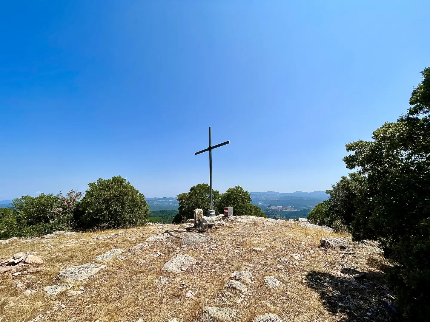
2h40' 8.10km ([to be completed])c Upon reaching the western ridge of Monte Calvi (599m), the vegetation thins out, giving way to ophiolitic outcrops. The route continues along the ridge towards the summit, passing through an environment characterised by serpentinites and specialised flora, including numerous species of wild orchids. The summit of Monte Calvi (646m) is a panoramic clearing from which the view extends across the Tuscan Archipelago, including the islands ofElba and Capraia, the Gulf of Baratti, the Piombino Promontory, the Metalliferous Hills and, on clear days, the Apuan Alps and Monte Amiata [3h00’T2] 8.50km .
The return journey follows the same route taken during the ascent [2h00’T2] 8.50 km (89 m elevation gain) (714 m elevation loss).
Comments (0)
Sign in to leave a comment